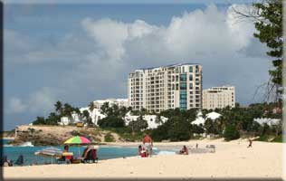
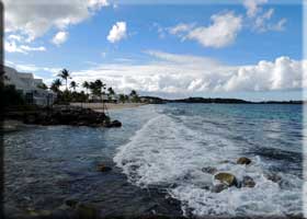
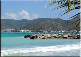
St Martin beaches | St Maarten Beaches St Martin Beaches St Maarten Beaches Sint Maarten Beaches Saint Martin Beaches

SXM: Info | Activities | Adult | Airport | Art | Beaches | Bookstore
Cars | Hotels | Map | Marinas | Medical | Services | Shopping
Restaurants | Real Estate | Travel/Airfare | Weddings
Kakao at Orient Beach St Martin Beaches St Maarten Beaches Sint Maarten Beaches Saint Martin Beaches

We have put together a few comments on St Martin's many beaches. Remember that beaches change gradually via erosion and replenishment and drastically via storms. Hurrucane Irma wiped out many beach restaurants in September 2017, especially on Orient. The information is accurate having been updated for the 2016/17 season before the storm, but tings change, mon! Reconstruction happens every day. The beaches on the east provide lots of morning sun while facing the shore and the beaches on the west will provide you with a glorious sunset into the water. Most beaches have some, if limited, amenities. There are also a number of all-inclusive resorts on the island to help you save on your vacation expenses. We have a separate section on snorkeling that has a fish identification quiz.

The map below has hot spots. Move the mouse to a beach name and click on it to get beach information and possibly some pictures. You can also try our beach finder. Tell us what would make your perfect day at the beach, and we will find the perfect beach. If you're going to the beach, get some reading material in out bookstore. There's plenty of mysteries, travel books, and a special section on the islands that includes fish identification books.

topper for Caribbean View Condo Vacation rental in St Maarten

Visit our one bedroom condo at Sapphire Beach Club

topper for Caribbean View Condo Vacation rental in St Maarten kitchen.html gardens.html bedroom.html photos.html

SXM_Map Guana Bay Little Bay Happy Bay Cupecoy Beach Bay Long Plum Bay Bay Rouge Nettle Bay Friar's Bay Grand Case Bay Anse Marcel Coralita Beach Ilet Pinel Orient Bay embouchure Oyster Pond Dawn Beach Pointe Blanche Great Bay Kimsha Beach Simpson Bay Maho Bay Mullet Bay

© all rights reserved
Designed by
KC Consulting


Great Bay St Martin Beaches St Maarten Beaches Sint Maarten Beaches Saint Martin Beaches Great Bay (Philipsburg) - You should go to Philipsburg for the shopping, casinos, and restaurants, but there is a beach and there are beach bars with plenty of facilities. After St Maarten dredged the harbor for the new cruise ship pier and terminal, much of the sand was used to replenish the beach. Thus, it is one of the longest and widest beaches on the island. Now that they have added a boardwalk they are expanding it further. The boardwalk is more of a great place to hang out and party than an idyllic tropical beach, but if that is what you want, check it out and look for great lunches at at some of the finer establishments on Frontstreet. The pano below was taken after the cruise crowd headed back to the cruise ships in the background.

Back to the map | SXM-Info
Great Bay St Martin Beaches St Maarten Beaches Sint Maarten Beaches Saint Martin Beaches

Great Bay St Martin Beaches St Maarten Beaches Sint Maarten Beaches Saint Martin Beaches


Beach at Little Bay St Martin Beaches St Maarten Beaches Sint Maarten Beaches Saint Martin Beaches Little Bay - Next door to Great Bay is Little Bay. The Divi Peninsula separates the two. The photo on the left was shot from the restaurant at the Belair Hotel and looks along the beach to the Divi Hotel in the distance. The photo on the right is looking straight out to sea with the America's Cup 12 meter boats in the foreground and Saba in the distance.

Back to the map | SXM-Info
Boats and Saba St Martin Beaches St Maarten Beaches Sint Maarten Beaches Saint Martin Beaches


Sunset Kimsha Beach - This is the far eastern end of Simpson Bay Beach, on the eastern end of the channel into the lagoon. Many of the boat trips start from this area, as it is outside the lagoon. There has been quite a bit of construction here, so access is limited, but there are beach bars. Greenhouse Restaurant has recently opened an outpost here. They are open from breakfast into the evening. On the left is a lovely sunset shot taken during the evening happy hour.

Back to the map | SXM-Info


Simpson Bay Beach - One of the longest and nicest beaches on the island. Lots of sand and generally small waves. Great views off to Saba and on good days, Statia, and on really clear days St Kitts and Nevis. The eastern end of the beach has limited access and limited street parking. You can turn at the eastern end of the runway to reach the middle of the beach. Here you will find public access and more likely street parking near The Horny Toad Guesthouse and the Azure Hotel. Sunset
Looking east
Looking east
Aerial view St Martin Beaches St Maarten Beaches Sint Maarten Beaches Saint Martin Beaches
The beach in the foreground
Turn right along the beach road to reach Mary's Boon with a restaurant and Karakter Restaurant, both of which have beach bars and chairs for rent. Karakter marks the end of the road. The sunsets looking over Beacon Hill are fabulous (above right). Below left is the seawall and private sunning area at the Horny Toad. In the center is the beach at Karakter.

The extreme western end of the beach can be reached by driving along the western end of the runway and turning left at Alegria. Eventually one comes to a place called Zafiro (Sapphire). It's been through several iterations over the last few years but in early 2016 it was a functioning restaurant and beach bar with chairs (below right).

Beach Beach Zafiro

Looking East from the Horny Toad
Looking east from the Horny Toad


Back to the map | SXM-Info

Air France landing at Maho St Martin Beaches St Maarten Beaches Sint Maarten Beaches Saint Martin Beaches Maho Bay - A little beach at the end of the runway next to big hotels. It has two attactions: The Sunset Bar offers free drinks to topless women and the low-flying aircraft. The photo on the right came from Leland Harms.

Back to the map | SXM-Info
Maho St Martin Beaches St Maarten Beaches Sint Maarten Beaches Saint Martin Beaches


Mullet St Martin Beaches St Maarten Beaches Sint Maarten Beaches Saint Martin Beaches Mullet St Martin Beaches St Maarten Beaches Sint Maarten Beaches Saint Martin Beaches
Mullet Bay - This was a very crowded beach when the Mullet Bay Resort was in operation in the early 90s. It is a very pretty beach on the sheltered side of the island with sunset views and this has made it very popular and usually crowded even without the resort. The foreground of the photo (above, left) shows some of the foundation from the resort's oceanfront building destroyed in 1995 by Hurricane Luis. The photo (above, right) shows Daleo's Snack with a plane approaching the airport. On the right is a 2012 photo taken from the north end of the beach, just past the two beach bars, showing Cupecoy Beach Club, The Cliff, and Rainbow in the distance. Below left shows Mullet as the quintessential Caribbean beach with lots of white sand, palm trees along the fringe of sea grapes on the beach, and volcanic mountains in the distance. Those are sea grapes below right.

Back to the map | SXM-Info

Mullet St Martin Beaches St Maarten Beaches Sint Maarten Beaches Saint Martin Beaches Mullet St Martin Beaches St Maarten Beaches Sint Maarten Beaches Saint Martin Beaches


Cupecoy Pools St Martin Beaches St Maarten Beaches Sint Maarten Beaches Saint Martin Beaches Cupecoy - Beautiful sandstone cliffs back up the beach, producing beautiful coves and caves, and as it faces SW, there are beautiful sunsets. Unfortunately Luis and Lenny and Omar in 2008 have made it smaller, but as always, it is coming back. The is the little cove just north of Ocean Club. The stairs have been rebuilt and Dany and Jean (on the right), are waiting for your arrival. Heading north, one reaches the monolith (which is not so monolithic anymore) and the remains of an old dock (left two photos). Further along is Shorepointe and very little beach. Dany and Jean at Cupecoy St Martin Beaches St Maarten Beaches Sint Maarten Beaches Saint Martin Beaches
Monolith at Cupecoy St Martin Beaches St Maarten Beaches Sint Maarten Beaches Saint Martin Beaches Cupecoy Pools St Martin Beaches St Maarten Beaches Sint Maarten Beaches Saint Martin Beaches rocks in front of Shorepointe St Martin Beaches St Maarten Beaches Sint Maarten Beaches Saint Martin Beaches Cupecoy Beach in front of Shorepointe St Martin Beaches St Maarten Beaches Sint Maarten Beaches Saint Martin Beaches
Cupecoy Beach St Martin Beaches St Maarten Beaches Sint Maarten Beaches Saint Martin Beaches The photo on the left is a bit deceiving as there is a lot of sand, but note that it is wet. The photo on the right was taken the next day as sand filled in the pools along the shore. It's still the same in 2007 (photos below on the left): a bit of sand is here, but big rollers move it around. New construction is certainly changing the look of the beach. Cupecoy Pools St Martin Beaches St Maarten Beaches Sint Maarten Beaches Saint Martin Beaches
Cupecoy Beach Mar 07 St Martin Beaches St Maarten Beaches Sint Maarten Beaches Saint Martin Beaches Cupecoy Beach Mar 07 St Martin Beaches St Maarten Beaches Sint Maarten Beaches Saint Martin Beaches There are photos on the construction feature and photos taken from a sailing trip. This is the NW end where there are beach boys with chairs and umbrellas. They serve drinks and grill up a few things. In case you hadn't noticed, at the NW end of the beach, clothing is optional. Cupecoy Beach Dec 06 St Martin Beaches St Maarten Beaches Sint Maarten Beaches Saint Martin Beaches

These are from March of 2008 taken from the Celine as we sailed by during the regatta. They show the entire beach from the NW edge (top left) with the Cupecoy Yacht Club construction coming over from La Samanna on the left, Shore Pointe in the center, and the open area that was supposed to become The Villages at Cupecoy. This open area serves as the access to the NW end of the beach. The next shot (top right) shows Pharos on the other side of the road, behind more open area belonging to The Villages at Cupecoy, Ocean Club, and the towers of Sapphire Beach Club. There is still a private villa between Sapphire and Rainbow Beach. You can see a bit of the property in the top right photo and most of it on the left of the bottom right photo. The rest of that photo shows the still growing Rainbow Beach development with its circular staircase access to the beach. On the bottom right is The Cliff (the tallest structure on the island) and Cupecoy Beach Club above the cliffs at the extreme SE end of Cupecoy.

Back to the map | SXM-Info

  Cupecoy Beach St Martin Beaches St Maarten Beaches Sint Maarten Beaches Saint Martin Beaches Cupecoy Beach St Martin Beaches St Maarten Beaches Sint Maarten Beaches Saint Martin Beaches
Cupecoy Beach St Martin Beaches St Maarten Beaches Sint Maarten Beaches Saint Martin Beaches Cupecoy Beach below Cupecoy beach Club and The Cliff at St Martin Beaches St Maarten Beaches Sint Maarten Beaches Saint Martin Beaches


Bay Long - A long beach with the expensive La Samanna complex at one end (the white buildings at the far end of the beach) and limited access in the center to a rather rocky beach. Other than Samanna, which will not let you in, there is no service on the entire beach. In 2011 they stopped allowing access from the main road to the road going to La Samanna forcing people seeking beach access to Bay Long to use the lowlands access closer to Bay Rouge. That access has a bar across the roadway. Those in the know, know that if you pull up to the bar, it will rise up during the day if the booth is unmanned. If there is a guard, tell him you are going to the beach and he will raise the gate. At night the gate is manned and you are not allowed into the area.
Plum Bay St Martin Beaches St Maarten Beaches Sint Maarten Beaches Saint Martin Beaches The beach is quite rocky in the center near the access. The rocks are somewhat visible in the photo on the left. The southeastern end near La Samanna has sand and northwestern end near the sewage treatment plant has sand. The small photo on the left is from 2015 and the other two photos are from 2017. A visit in January 2019 shows that the beach is better than ever.

Back to the map | SXM-Info
Bay Long St Martin Beaches St Maarten Beaches Sint Maarten Beaches Saint Martin Beaches

Bay Long St Martin Beaches St Maarten Beaches Sint Maarten Beaches Saint Martin Beaches


Plum Bay (prunes in French) - A pretty beach, but rocky and a bit rough. Great sunsets because it faces west. No facilities at all. The panoramic photo below is the entire left (south) part of the beach as it looks from the entrance. President Trump owns Château Palmiers (Tower of Palms). The beachside part of the estate is under the highest cloud on the right side of the pano. On the right is the right or northern sweep of the beach. That photo is from 2017. The photo of the north beach on the right is from 2019. In 2011 they stopped allowing access to the lowlands via the road going past La Samanna, forcing people seeking beach access to Bay Long and Plum Bay to enter the lowlands access closer to Bay Rouge. That access has a bar across the roadway. Those in the know, know that if you pull up to the bar, it will rise if the booth is unmanned. If there is a guard, tell him you are going to the beach and he will raise the bar. At night the gate is manned and you are not allowed into the area.

Back to the map | SXM-Info
Plum Bay St Martin Beaches St Maarten Beaches Sint Maarten Beaches Saint Martin Beaches

Plum Bay St Martin Beaches St Maarten Beaches Sint Maarten Beaches Saint Martin Beaches


Bay Rouge West St Martin Beaches St Maarten Beaches Sint Maarten Beaches Saint Martin Beaches Bay Rouge - Bay Rouge is named for the pinkish cast of its sand. It's a pretty beach with the Falaise des Ouiseaux (Bird Cliffs) to the west and David's Grotto on the east. The photo on the left from 2016 looks along the beach from the entrance next to the two beach bars over to the cliffs. There is about a mile of mostly sandy beach off to the west of the entrance. The other photo shows the rocks that start the formation that encloses the grotto. Below are photos of the grotto from Feb 2006. However, Bay Rouge was devastated by Hurricane Irma in September of 2017. As of January 2019, the restaurant and bar have been reduced to a table holding a couple coolers and a tarp. They do rent chairs and umbrellas. Bay Rouge East St Martin Beaches St Maarten Beaches Sint Maarten Beaches Saint Martin Beaches

David's Hole David's Grotto or Hole is this circular hole in the cliff on a point between Bay Rouge and Nettle Bay. It reaches down 30 feet to sea level and two other holes connect it to the sea. It has suffered in various storms and may look different at this time. Below is pano of the Bird Cliffs taken in 2016.

Back to the map | SXM-Info
David's Hole

Bird Cliffs


Nettle Bay Beach was hit hard by Irma in 2017. Le Sand and Dreams are no more. Hotel Mercure bought the remains of Ma Ti Beach and Layla's, giveing them access to open water. I wouldn't get in the lagoon. Mezza Luna seems to have weathered the storm. Here's a shot from Dreams looking toward the remains of La Belle Creole destroyed by Hurricane Luis in 1995.

Nettle Bay Beaches

We went to Mezza Luna in 2016 and again in 2017. It's a fairly good sized restaurant with another 50 seats out on the beach. The wind was pretty bad so we got a seat in the restaurant overlooking the beach and watched the salad greens blow off plates being delivered to tables on the beach. The middle photo below is the view looking west across Ma Ti Beach, Dreams, and Le Sand. The photo on the right the eastward view from Mezza Luna toward Marigot.
Nettle Bay Beaches Nettle Bay Beaches Nettle Bay Beaches
The pano below shows the ruins of La Belle Créole, destroyed in 1995 by Hurricane Luis.

Nettle Bay Beaches


Friar's Bay St Martin Beaches St Maarten Beaches Sint Maarten Beaches Saint Martin Beaches Friar's Bay - A small, rather pretty and very protected cove with two beach bars: Kali's Beach Bar (foreground in the photo on the left) and Friar's Bay Beach Café (background). Kali's is Jamaican/Créole and Friar's BBC does pretty good French cuisine. They both provide chairs and umbrellas. There are also covered tables for dining on the sand. The road in 2017 is in better shape than our last visit showed. Kali's does a full moon party that packs the cars in, so be prepared to stay a while. The pano below shows how calm the bay can be.

Back to the map | SXM-Info
Friar's Bay St Martin Beaches St Maarten Beaches Sint Maarten Beaches Saint Martin Beaches

Friar's Bay St Martin Beaches St Maarten Beaches Sint Maarten Beaches Saint Martin Beaches


Happy Bay - A short walk up and over a hill at the northern end of Friar's Bay brings you to Happy Bay, a very secluded beach with few amenities (Danny provides chairs, food, and drink), but there is a grandiose project on the books. And it is still on the books in 2011, as there has not much action on the French side. They are still talking in 2017. Some people have been spotted working on their all-over sun tans at this beach. This photo was taken from Random Wind as we sailed by in Jan of 2005.

Back to the map | SXM-Info
Happy Bay St Martin Beaches St Maarten Beaches Sint Maarten Beaches Saint Martin Beaches


Grand Case Bay St Martin Beaches St Maarten Beaches Sint Maarten Beaches Saint Martin Beaches

Grand Case Beach - There is some street parking and a bit of free parking in the lot in the center of town. There are great sunsets. The picture was taken from Sunset Café at the Grand Case Beach Club. The shot on the left below shows little sand at the eastern end of the public section of Grand Case Beach as it comes to Grand Case Beach Club. The photo below right shows that the same area taken from the west looking east. On the right you can see that Grand Case Beach Club has a small amount of beach on other side of its property. The photo below right is from 2009 and the others are from 2012.

  Grand Case Bay St Martin Beaches St Maarten Beaches Sint Maarten Beaches Saint Martin Beaches
Grand Case Bay St Martin Beaches St Maarten Beaches Sint Maarten Beaches Saint Martin Beaches
Back to the map
SXM-Info
Grand Case Bay St Martin Beaches St Maarten Beaches Sint Maarten Beaches Saint Martin Beaches


View of Anse Marcel Beach St Martin Beaches St Maarten Beaches Sint Maarten Beaches Saint Martin Beaches Anse Marcel - A hotel controls access to the beach so you have to park outside their grounds and walk in to the beach. Once you are there, you will find that the beach faces north and is hemmed in by high hills on the remaining three sides. It is calm and there are amenities. The best part is the view from the hill (see below).

Back to the map


Ilet Pinel - This uninhabited island has some facilities during the day and is a great spot for snorkel trips and picnics. It's a short ride in a beach taxi from Cul de Sac or a bit longer from Orient Beach. If you need a book to help identify the fish, check out our bookstore. There are two restaurants open for lunch.

The view from the road to Anse Marcel

View from Red Rock looking south St Martin Beaches St Maarten Beaches Sint Maarten Beaches Saint Martin Beaches

Wide angle view

Cul de Sac St Martin Beaches St Maarten Beaches Sint Maarten Beaches Saint Martin Beaches

Back to the map | SXM-Info


Above is a panoramic shot of the middle of Orient Beach showing Green Key protecting the shore.
This was taken from Paradise View Restaurant high on Hope Hill.

Above is a panoramic shot of the middle of the northern end Orient Beach showing the rocks near Coco and a bit of Green Key.
This was taken from the hill inland from Palm Beach Restaurant.

Orient St Martin Beaches St Maarten Beaches Sint Maarten Beaches Saint Martin Beaches Orient Beach - Despite being on the windward eastern coast, this is one of the gentlest of beaches because of the protection afforded by the reef running from the south to Green Cay and beyond. The well-protected southern end of the beach is clothing-optional. There is a reef running southeast from the start of the nude section that is home to many fish. If you need a book to help identify the fish, check out our bookstore..

Before Irma, watersports were plentiful and there were several fine, full-service restaurants right on the beach and many more shacks including those in the reconstruction project that took up much of 2016, but by January 2017 they are back in operation. By 8 September 2017 they were destroyed. The bottom pano will expand if clicked.

Earlier Orient photos
Back to the map | SXM-Info


Arty view of Galion Beach St Martin Beaches St Maarten Beaches Sint Maarten Beaches Saint Martin Beaches L'Embouchure or Galion Beach - It's a large, extremely calm, eastern-facing beach past the Butterfly Farm. Chez Pat/Tropical Wave has chairs, umbrellas, food, drink, outdoor equipment, and St Barts in the distance. This is a great place for windsurfing. The bay is protected and calm, but there are good breezes. The pano below shows the wide sweep of peninsula that fades into a reef. Both of which keep the waters of the bay calm while allowing the trade winds free passage. The bottom pano will expand if clicked. Unfortunately, the French government and Hurricane Irma have conspired to shut down the operation(s) on the bay.

Back to the map | SXM-Info
View of beach chairs and kayak St Martin Beaches St Maarten Beaches Sint Maarten Beaches Saint Martin Beaches

View of beach chairs and kayak St Martin Beaches St Maarten Beaches Sint Maarten Beaches Saint Martin Beaches


View of Coralita St Martin Beaches St Maarten Beaches Sint Maarten Beaches Saint Martin Beaches
Coralita Beach

It's a beautiful shallow, eastern-facing, wind-swept tidal pool. There was a rustic, unpermitted beach bar and not much sand. It has been removed, so there are no facilities except this view tower.

Back to the map | SXM-Info
View of Coralita and sailboat


View of Oyster Pond and boats Oyster Pond - Not much beach here, but it is very safe and beautiful harbor ringed with hills. Well worth the trip over the steep hill (if you approach from the south), especially for this view from the hill. Mr Busby's Beach Bar and ancillary businesses suffered greatly as Hurriccane Irma passed through. Heading north to Orient Beach is a short and beautiful drive along the shore.

Back to the map | SXM-Info


Dawn Beach - A pretty beach that is fairly well protected. There is either good snorkeling or if the surf is up, good boogie boarding. If you need a book to help identify the fish, check out our bookstore. Follow the signs to Mr Busby's Beach Bar to find the northern end. It doesn't look like this anymore as the Westin built a prison-like fortress on the site, bulldozing the ruins of the old Dawn Beach Hotel and much of the hillside, and filling the mangrove pond.

Back to the map | SXM-Info
Dawn Beach St Martin Beaches St Maarten Beaches Sint Maarten Beaches Saint Martin Beaches Dawn Beach St Martin Beaches St Maarten Beaches Sint Maarten Beaches Saint Martin Beaches


Guana Bay - There is a bit of a beach, but the water on this eastern-facing beach can be rough and so is the beach in many spots. Photo by Glenn Akers.

Back to the map | SXM-Info
Guana Bay St Martin Beaches St Maarten Beaches Sint Maarten Beaches Saint Martin Beaches


Pointe Blanche - You can get nice views from this point, but not much swimming. Mary Titus, editor for Rocky the dog, says "The bay is a little scruffy for sun tanning etc. but on calm days very nice for snorkeling and diving. It occasionally has great surf for short board surfing." Photo by Glenn Akers.

Back to the map | SXM-Info
Pointe Blanche St Martin Beaches St Maarten Beaches Sint Maarten Beaches Saint Martin Beaches


© all rights reserved
Designed by
KC Consulting


SXM:
Info | Activities | Adult | Airport | Art | Beaches | Bookstore | Cars
Casinos | Hotels | Map | Marinas | Medical | Services | Shopping
Restaurants | Real Estate | Travel/Airfare | Weddings